Fluebrig Rundwanderung

| Length | Ascent | Descent | Minimum height | Maximum height | Approximate duration |
|---|---|---|---|---|---|
| 12.94 km | 1223 m | 1224 m | 921 m | 2092 m | 6:00 h |
Pam Hefti with Caya and Damon (from 11.09.20):
We started in Studen SZ Ochsenboden. If you drive from Studen SZ by car towards the golf course, there are free parking places at the roadside (at the golf course you are only allowed to park for golf or restaurant at the moment). From there we started in the direction of the golf course and followed the signs to Fluebrig at the parking lot of the golf course. First we walk on a wide gravel road through the woods (Stafelwand), then we have a little brook and water for the dog. There where the way becomes narrower, the trees disappear. It goes more and more steeply up the slope and soon there is a bigger brook to cross and then there is water for the dogs on the way down again. And just behind this brook the first cattle fence comes. But the sheep were far away.
Further up there is like over a saddle and the horizon becomes wide and the view is already great. A short orientation and further uphill towards Fluebrig. At the top we were a little bit helpless, we stood in front of a white cloud wall. We turn around and have a great view on Mythen and the surrounding mountains but also a far view on distant snowy peaks. But there is a big cloud today which makes it a bit difficult to see. But also the cloud was beautiful.
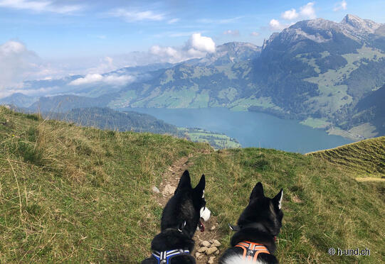
The descent is on good hiking trails, hardly any loose stones. When we were out of the clouds we had a fantastic view on the Wägitalersee. There you cross another sheep pasture and later a cow pasture. At the Fläschlipass we followed the signposting to Studen. There is a new trail through the shady forest down and ebdet at the parked car.
The gallery does not contain any pictures yet


