Älggialp - centre of Switzerland circular hike

| Length | Ascent | Descent | Minimum height | Maximum height | Approximate duration |
|---|---|---|---|---|---|
| 9.54 km | 481 m | 480 m | 1467 m | 1842 m | 3:00 h |
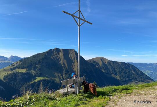
Reto and Tanja with Kesh (from 01.10.21):
We drive by car from Sachseln to the Älggialp. The road is very narrow and on Wednesday and weekend there is a one-way regulation, (see homepage of Obwalden Tourism).
As the alp is hibernating and there is no winter service for the road, I recommend to drive up only from June to mid-October. Except on Wednesdays, weekends and school holidays, the alp is hardly to moderately frequented.
We park in the public parking lot and pay a voluntary parking fee. We hike first towards the triangulation pyramid, which marks the center. We pass the Berggasthaus Älggi with a nice terrace. In front of the midpoint, there is also a nice fireplace with a whole pile of wood.
Afterwards, we continue across the moor following the markings of the mountain hiking trail towards Melchtal. The path goes steeply down over wet and rocky ground through mountain forest area. Later we climb up again and come across a cow pasture. We only meet cows here, most of them must have moved down into the valley. We walk at the very edge of the pasture and go under the Haag and thus traverse back to the marked path.
At the alpine hut Lungeren Seefeld we take a break on a nice bench with a view. We continue to the next alpine hut Seefeld. Here you can see the Seefeldsee, where you can fish. Day passes can be obtained online or at the Älggialp mountain inn.
Now it goes first over pastures and then through a rock wall with a staircase down to the moor of the Älggialp. If you don't like the rock stairs, you can also take a detour via the road.
Happy and tired we reach the parking lot again.
The gallery does not contain any pictures yet


