Langwies - Uf Wald

| Length | Ascent | Descent | Minimum height | Maximum height | Approximate duration |
|---|---|---|---|---|---|
| 8.36 km | 306 m | 551 m | 1039 m | 1427 m | 2:30 h |
Pius and Miriam with Gypsie and Mia (from 01.06.18):
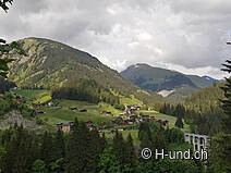
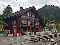
Since we had to work this morning, we start our hike today in the afternoon. At 16.10 o'clock we start walking at the train station in Langwies. The temperatures are pleasant, the sun is covered by some big clouds. First a narrow path leads us over a beautiful flower meadow and through the forest to the Langwieser Viaduct. The 284 m long structure is by far the largest bridge of the Rhaetian Railway. It swings 62 metres high over a gorge. From the viaduct we follow the zigzag path downhill, cross the Sappüner Bach and the Plessur and climb up again on the left bank until we reach a wide gravel road which is only passable with a permit. We are now in the large Prätschwald forest on the northern slope of the Aroser Weisshorn. Along this road we first hike slightly up and down, then only gently down until after 1.5 hours we reach the bridge in front of Molinis, which lies 10 km east (as the crow flies) of Chur. In the summer of 1980 the village and its church were destroyed by an avalanche of mud and scree and rebuilt in 1982. From now on we follow a tarred road through the forest and turn into a narrow path at a turn-off. This leads us down through a stream ravine until we cross the Grossbach over a small bridge. For the dogs the many brooks on the way are ideal. They can drink enough and cool down again and again. However, it can be assumed that during the summer and autumn months certain streams will be dried up.
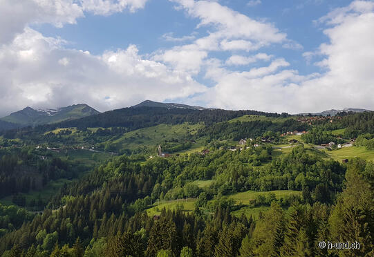
On the other hand, we alternate between dark forest and lush pastures in constant up and down to the clearing Uf Wald. Here we find a perfect place to sleep at 18.50. From up here we have a great view into the valley Schanfigg towards Chur. We don't put up the tent tonight, we just sleep in our sleeping bags, listen to the sounds of nature and enjoy the starry sky. Later in the evening it starts to rain, but since our sleeping place is covered, we are well protected and stay dry.
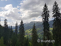
Our stage today was only 9 km long with about 1'000 meters altitude difference. We liked it very much, because we could look through the trees to the other side of the valley from time to time. Moreover, the path was mostly in the shade, which especially pleased the dogs.


